Kashmir Great Lakes: Trekking along the majestic lakes of India's Himalayas
- chasing peaks

- Oct 1, 2025
- 26 min read
Updated: Oct 2, 2025
18 August 2024

Elevation - 4,200 masl
Elevation gained - ~ 3,500 m
Distance - 72 km
Total time taken - 8 days (1 buffer day in the event of bad weather)
Climbing period - July to September
Difficulty - 4/5 moderate (long distance trekking at high altitudes)
Trail type - Soil/ mud terrains with some rock scrambling sections
Requirements - Sign up with a certified tour provider
Kashmir Great Lakes, a place also known as paradise on Earth. It is one of the most beautiful treks in India, where we were treated to a panorama of rugged mountains, rolling meadows, and blue alpine lakes every day. The trek passes 3 mountain passes, with the highest being Gadsar Pass at 4,200 masl, with a total distance of around 72 km.
After seeing photos of the pristine lakes and stunning mountain landscapes, I have long aspired to do the Kashmir Great Lakes hike. After thinking about it for just a couple of years (lol), my friend mentioned that he was going to do the Kashmir trek this year, and I took it as a sign to finally attempt it! It was the longest trek I have done to date, 8 days in total with 6 full days of trekking, all while camping outdoors. I naturally had many concerns but there is always a first for everything!
Overview
Trip Planning
We booked our trip with Trek the Himalayas (TTH). They have set-off dates almost every week during the peak trekking period, with trips getting booked up very quickly. This was, after all, the most popular trek in India! There were 22 of us in total—12 of us from Singapore joined another 10 Indian locals on the trek. TTH provided all the information and preparation required for the trip. There was even an online briefing and regular notifications to submit documents prior to the trip. There's quite abit of paperwork required so do start prepping early!
These are the required documents to prepare for the trip:
Medical Form signed by a doctor
Self-Declaration Form
Passport Copies (3)
Travel Visa (3)
Passport size photos (2)
Insurance Document
Some useful elevation maps for reference:
(Source: Trek the Himalayas)


Costs
Tour - INR 17,300
(Including: guides, tents, meals and sleeping bag)
Transport from Srinagar trailhead and back - INR 1,700
Mule portering - INR 2,100
cost indicated is per pax
Getting There


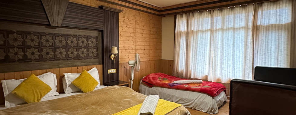

We opted to travel there a day earlier to acclimate, as the base camp was already well over 2000 meters above sea level. We flew to Delhi and then transferred to Srinagar. From Srinagar, we chartered a van to take us to the town of Sonamarg (even though TTH offered transportation from Srinagar, the pickup was scheduled for the next day). By the time we reached Sonamarg, it was late afternoon, and I felt a bit queasy, likely due to the altitude. We spent the rest of the day exploring the town. Walking around definitely helped, as I felt much better after a while.
Sonamarg is a small but beautiful town nestled among the mountains, with an army camp and a small row of shops. The military presence was very noticeable; soldiers were stationed every 100 meters or so, and we were not allowed to take photos or linger near the army campsite. As foreigners, we were not permitted to purchase local SIM cards and had to rely on Wi-Fi for connectivity.
We made sure to enjoy our last day of sleeping on a proper bed and eating good food before embarking on the week-long trek…
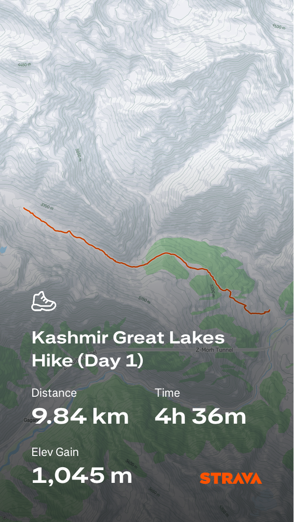
Day 1 - Arrive at Shitkadi Basecamp
1500 | Reach Shitkadi Basecamp |
1930 | Dinner and rest |


1500 | Reach Shitkadi Basecamp
We hired a van to bring us to Shitkadi Basecamp, which was only a 15-minute drive from the town of Sonamarg. At the campsite, we were assigned our tents; it was 2 people to a tent. There were also 3 smaller tents meant for use as toilets. The toilets were literally just holes dug into the ground. But honestly, the smell was not as bad as I had imagined, as long as you cover the poop with a layer of soil afterward!
We were served chai and snacks while we waited for the rest of the group to arrive. They then huddled us together to settle some administrative work - submitting the required documents, taking blood pressure and blood oxygen levels. There was also a group of merchants that traveled all the way to our campsite touting their goods with bags of scarves to sell. Though I'm no expert, the scarves seemed to be of pretty good quality and relatively cheap, so I bought a few to use for the trek.
1930 | Dinner and rest
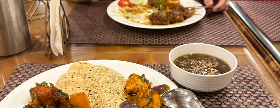
Then it was dinner before settling in for the night. Dinner was pretty simple, dal and rice, and we will only be having Indian vegetarian food for the rest of the trip. As for water, we could get it from a tap at the campsite. They claimed the water is safe for drinking, but it looked oddly cloudy so I filtered it before drinking (the locals however, drank direct from the tap). The filter bottle was definitely my best investment for the trip!
Day 2 - Shitkadi to Nichinai
0630 | Pack up and set off |
1200 | Rest stop at maggie point |
1400 | Lunch break by the river |
1700 | Arrive at campsite |


0630 | Pack up and set off
It was officially the first day of our trek! We got up early in the morning to start packing for the trek ahead. We had to first label and pack our sleeping bags (rented from TTH). Then, another round of frantic packing for the mule bag, which includes most of the camping gear and an extra change of clothes to be carried by the mule, as well as our own daypack. My mule bag weighed around 10 kg and my daypack 6-7 kg, including 2 liters of water (I might have overpacked, tbh). We ate our breakfast, collected our packed lunch, and set off for our long-awaited trek!
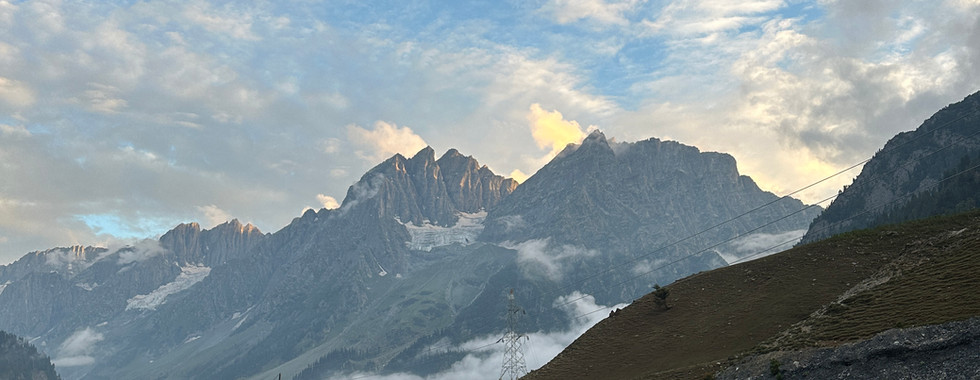
It was uphill right from the start… and a lot more to come since the first day had the most elevation gain, about 1,000 m. After the first climb, we looked back to catch a last glimpse of civilization and said our goodbyes to the town of Sonamarg. It was now just us and the mountains. We continued inland and soon reached the first army checkpoint. We were prohibited from taking photos of the army checkpoint or the soldiers. I have heard stories of people getting caned or their phones confiscated for taking photos, so I am not risking it. We waited quite a while for the soldiers to verify our documents before setting off again.
There were quite a number of hikers on this trek, a hundred or so (it is, after all, the most popular trek in India), mostly locals and rarely any foreigners, so we definitely stood out. Uphill climbs felt a lot harder at this altitude, and we slowed our pace to avoid getting AMS. The guides were constantly shouting 'Chalo Chalo' at us, which kind of means keep going.


1200 | Rest stop at maggie point
After walking through an open field, we were excited to see the first Maggie Point! It is a small tent set up selling chai, curry mee, and omelette. The food tasted super good, especially after working hard for it. On the way, I saw a hiker lying on a rock who looked like she had pretty bad AMS, and later on, someone who was violently vomiting. Coming a day earlier to acclimatize was definitely a good choice.
We continued our trek through a small forest area, then along the side of a mountain down to a stream. The scenery was breathtaking everywhere we looked, and we felt especially small against the backdrop of giants, like a tiny trail of ants meandering around the mountain.
1400 | Lunch break by the river
We finally reached the stream and stopped for lunch. The packed lunch consisted of chapati and some lady's fingers. The food was pretty simple but tasted quite okay. There were also cows roaming around, eyeing our food, and we had to constantly dodge them while eating...


1700 | Arrive at campsite
We traced the river and continued uphill towards our campsite. Every time we turned a corner, I hoped to see our campsite. We passed many campsites but still didn't spot our red tents. Eventually, we spotted our red tents in the distance. It's incredible how the guides still had the energy to play cricket at the campsite!
We busied ourselves with our afternoon routines before it got dark, washed our lunch boxes and utensils by the river, and filtered water for the following day. The guides reminded us to drink at least 2L of water a day to prevent AMS. The temperature drops drastically once the sun starts to set, so we had to be prepared to quickly layer up. They would also take our oxygen level daily to make sure we were well acclimatized, especially since we had very quickly ascended to 3,500 masl. My oxygen level was pretty low the first few times, and I only managed to 'pass' after warming up my hands (the passing level was 80 SpO2).
Day 3 - Nichinai to Vishansar
0730 | Pack up and set off |
1015 | Reach Nichinai Pass |
1040 | Through the flower fields |
1230 | Lunch break |
1430 | Arrive at campsite |
1630 | Visit Vishansar Lake |


0730 | Pack up and set off
Today we will be passing the first of 3 passes in Kashmir, Nichinai Pass at 3,990 masl. We set off bright and early after having our breakfast and packing our mule and daypacks. We immediately started ascending, and not before long it began to rain. It started as a light drizzle, so we stopped to put on our rain gear. I had initially thought it would just be a passing rain, but it soon started pouring as we continued on the ascent up to Nichinai Pass. More than just the rain, it was the cold that was unbearable. My hands were so cold that they turned red ;(. I felt miserable but kept pushing forward to the pass. The last ascent was the hardest as I began to feel light-headed from the cold. I definitely should have layered up and worn a beanie.
1015 | Reach Nichinai Pass
It was pure relief when we spotted a Maggi stop at the top of the pass. We all crowded into the hut, huddled together in the dark. Nothing was better than a hot cup of chai at that point. After drinking the chai I felt alive again! I took the chance to quickly layer up with a fleece jacket before we had to continue on the trek.


1040 | Through the flower fields
It was so difficult to leave the comfort of the hut, but at least the road ahead was mostly downhill. As the rain continued pouring, we set off downhill across a beautiful flower field. The atmosphere felt a lot lighter with the changing scenery, and we stopped every so often for some photos. The path became extra muddy and slippery with the constant rain, so the guides had to bring us through alternative paths. We saw a dead horse lying across the path at some point, and I wasn't sure if it was a mule or a wild horse. A little further on, a herd of sheep started coming towards us.
1230 | Lunch break
We finally reached a patch of field where we stopped for lunch. We had chapati and potatoes for lunch. I didn’t have much appetite, but I tried to at least eat a bit for the energy. As we ate, we were chased around by sheep vying for our food.
The rain had finally stopped, and the rest of the way to our campsite was slow and leisurely, a stark contrast to the tiring climb in the pouring rain at the start of the day. The guides entertained us by chasing a herd of sheep around and caught a baby sheep for us to carry. The fur of the baby sheep was a lot softer, but the mother sheep came running towards us meh-ing loudly, so we returned the baby.


1430 | Arrive at campsite
It was late afternoon when we reached our campsite and wasted no time in washing and drying our wet clothes and sleeping bags while the sun was out. We strung all our wet clothes on the tent, hoping the remaining sunlight for the day would dry out our gear.
1630 | Visit Vishansar Lake
After our afternoon tea break, the guides took us to see the first lake of our trek, Vishansar Lake. It was a short 5-minute hike uphill to get to the lake from the campsite. Just as we reached the top of the small hill, we saw the stunning lake come into sight. The lake was huge and surrounded by rugged mountains in the back. We took our time to walk around, exploring every corner of the lake. There were many horses lazing around the lake, but they looked emaciated. Two dogs were also playing around, frolicking in the grass.
We only reluctantly walked back to the campsite when the sun started setting and the temperature dropped. That night we had a simple meal of noodles and beans before turning in for the night. Nights in the mountains were crazy cold, and I had to plan each toilet trip well to minimize leaving the tent too often. It was also a different ordeal navigating to the toilet tents while avoiding cow poop in the dark.
Day 4 - Vishansar to Gadsar
0530 | Breakfast before the hike |
0615 | Set off for the day |
0830 | Last push to the Pass |
1015 | Reach Gadsar Pass (highest point of the trek) |
1245 | Lunch break by the glacier lake |
1600 | Arrive at campsite |


0530 | Breakfast before the hike
Today will be a long day and possibly the most challenging day as we cross the highest pass of the trek, Gadsar Pass at 4,190 masl. I was definitely worried about getting altitude sickness and was hoping that the previous days of hiking had helped to acclimatize the body.
We were up having breakfast at 5:30 a.m. and packed for the day ahead. I didn't think my stomach was ready for breakfast, but the cup of hot chai in the morning was much needed.
0615 | Set off for the day
We set off earlier than usual to cover the distance for the day. The first section was still pretty flat as we crossed the field and some small boulder area. The trail took us to the other side of Vishansar Lake, and the view again was breathtaking. The water was still and mirrored the majestic mountain towering in the background. We couldn't help but stop for some photos at this sight.
The trail started to climb upwards, slowly snaking its way up the mountain. We could see our goal for the day, Gadsar Pass in the far distance. It was still a long, long way to go. As we made our way up, the view of the lake grew more and more distant. As much as the road feels endless, it is good to turn back once in a while to see how far we have come.
I maintained a slow and steady pace so as not to have my heart rate go up too fast, to prevent getting altitude sickness. We continued on our journey where a second lake came into sight. It was another huge lake, I believe it's called Kishansar Lake. Another beautiful view to accompany us as we continued our tiresome climb.


0830 | Last push to the Pass
The first part of the slope is not as steep and we made good progress albeit huffing and puffing our way up. The trail then made a sharp turn following the hill, the path became steep and we had to watch our step as it was a drop to one side. A few hikers passed us on mules, not going to lie it was definitely tempting to choose to go up on a mule. We stopped by a ledge overlooking the lake for a short break and also to admire the view. From this angle, we could see the entire lake and the view was breathtaking. It's hard to believe that we have already climbed so far, though the road ahead is still long. I was a bit lightheaded at this point and had to tread carefully along the ledge.
The trail ahead zigzagged up the mountain. The mules took the main trail up, and to avoid squeezing with the mules, we had to walk straight up the steep end of the mountain. Every step was painful at this point, and we walked at a crawling pace, having to stop every few steps to catch my breath. I really did question if we could make it to the top, but every once in a while when I lifted my head I could see the pass slowly getting closer. Looking back on the photos, I could see the pain on our faces as we hiked this portion.


1015 | Reach Gadsar Pass (highest point of the trek)
We were elated when we reached Gadsar Pass at 4,200 masl! This was the highest I have hiked so far, and I was proud to have made it despite the struggle. We were all smiles as we joined the rest of the group for photos as proof of our achievement. We almost immediately forgot the pain of the climb.
We then had to quickly descend as it was still a long hike ahead to our campsite for the day. We descended down a rocky path; though the landscape was mostly grey, there were pops of colors here and there, yellow and purple.


1245 | Lunch break by the glacier lake
We passed a few smaller lakes - Yamsar Lake as we made our way down, and stopped at another glacier lake for lunch (I believe this was Gadsar Lake). You could see the glacier slowly melting, converging into a stream steadily flowing into a beautiful blue lake. The sight was beautiful, but it was sad to think that the glaciers will soon be gone for good. We had biryani for lunch. It tasted okay, but I missed having meat.
We continued our hike following the flow of the river. There were small glacier bridges here and there from half-melted glaciers. The trail was straightforward but long and endless. The guide pointed out some small animals in the distance, marmots.
After what felt like eternity, I spotted our group gathered by the side of the trail. Apparently, we needed to wait for the entire group to arrive as there was an army camp up ahead. When I sat down, it was finally apparent how sore my feet were. We reported at the army camp and the check was quick. They called out names one by one and checked our documents before letting us head to the campsite. As we passed a maggie point, my friend immediately ran up to get omelette lol.
1600 | Arrive at campsite
We reached the campsite and was just glad to be done with the longest and highest trekking day of the trip. We were served aloo chop for a tea time snack that day, and it was so good we requested more servings. We did our usual chores and rested for the day. There was a small commotion towards the evening, and we saw some of the army soldiers coming in. Apparently, one of the hikers from a different group had very low blood oxygen and had to be quickly rushed down the mountain. Altitude sickness is very real, and it was a reminder that we have to properly take care of ourselves. The night sky that day was beautiful, and you could even see the Milky Way with your naked eyes.
Day 5 - Gadsar to Satsar
0800 | Set off for the day |
0900 | Berry picking up the mountain |
1200 | Short break at maggie point |
1430 | Arrive at campsite for lunch |
1830 | A very cold night |


0800 | Set off for the day
To make up for the previous day, which was the longest and most physically strenuous day of the trek, we were given more rest and started the hike later than usual at 8 am. I was relieved to know that the route that day would be relatively shorter with only about 20 minutes of uphill (according to the guide). We first crossed over a white terrain to get to the other side of the mountain. As we got closer, I realised it was a huge ice bridge connecting our side of the mountain to the other side. I was surprised at how the ice stayed frozen despite the warm morning sun. It was quite abit of queueing and waiting to cross the ice bridge.
After a brief ascent, we continued tracing the circumference of the mountain. The views were superb as usual, making the trek feel like a breeze. After an enjoyable scenic walk, we turned a corner and was not too excited to see the upcoming ascent zigzagging up the mountain.
0900 | Berry picking up the mountain
We had to give way to the mules, and took the alternative steeper trail up. I noticed a guide picking something from the ground and putting it in his mouth. I went over to see what they were picking, and saw that it was a tiny red strawberry. I did not even notice there were fruits growing before. And so, I tried looking around for the tiny fruits; there were indeed tiny specks of red peeking through the grass. It became a side quest as I collected as many tiny strawberries as I could find and ate a few. It helped to distract me from the uphill climb.
Before I realised, I reached the top of the hill.
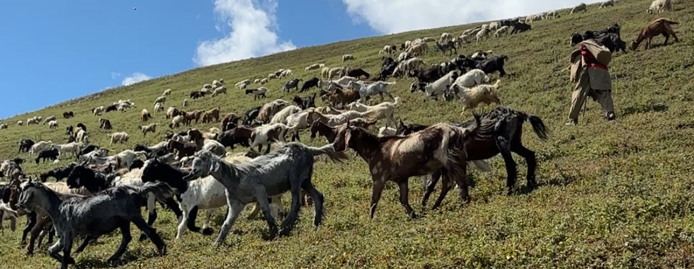
At the top of the hill, we took a short break to catch our breath before continuing. The trail was back to being relatively flat at this point. We then saw a huge herd of goats running down from the top of the mountains towards us in a stampede. A herder was herding them towards the bottom of the mountain. The past few days we mostly saw sheep and mules, and it was the first time seeing a huge herd of goats. They were a lot bigger than I thought, about twice the size of sheep.


1200 | Short break at maggie point
We reached another clearing and rested for a while before heading towards our campsite. Since the hiking distance is shorter that day, we would be having our cooked lunch at the campsite instead of having it packed. We stopped at a maggie point for more curry mee and chai (we can never have enough of this!). After our short refuel, we were also eager to quickly make it to our campsite to enjoy an extended break.
Th trail continued through a big field along the valley. There were occasional patches of boulders to cross, but we were getting more skilled at boulder crossing. We then reached a series of small lakes, Satsar Lakes. There was a small tent selling apples next to one of the lakes, and I bought one to munch on as we hiked the final leg of the journey to the campsite. It was a small green apple but tasted mildly sweet.


1430 | Arrive at campsite for lunch
We settled down at our campsite and were excited to eat our freshly prepared meal. Since we had a lot more time that day, I decided to finally wash my hair. Yes, we did not bathe at all on the entire trek, and my hair was definitely getting clumpy at this point and very much in need of a wash. I went to the river with my cup and towel and poured the water over my hair to rinse. I shuddered as the river water was surprisingly cold. I was cautious to quickly dried my hair after as the cold can make you more prone to altitude sickness. There were people inside the river washing their entire bodies, I don't know how they are surviving the cold.
The rest of the afternoon was spent lounging around the campsite. There was an option to do a hike to reach a small waterfall which was tempting, but I felt my body needed rest. For tea break, the guides made us some fried crackers; they always made sure that we were well fed. Just before sunset, we decided to explore a little. I had on a shell layer and we made our way up over a small hill overlooking the valley. The sun soon dipped behind the mountain, casting a shadow over us. Standing in the shade, it suddenly became freezing.
1830 | A very cold night
After reaching back at the campsite, I quickly put on a few more layers, including a down layer. The guide warned that this will be the coldest campsite we would be staying at, as it is situated between two valleys with strong winds passing through. They also took our blood oxygen level much earlier than usual so we could retreat from the cold. My blood oxygen level was lower than usual, around 70+. I was pretty worrying and I had to get it reassessed three times before they passed me. A few in the group also had low blood oxygen and symptoms like diarrhea and vomiting.
I could feel that I was getting a little sick that night as I couldn't stop shivering even after putting on 4-5 layers of clothing. I also didn't have much appetite and could only eat the instant porridge. The following day would be another long day, and I tried to get as much sleep as I possibly could. Unfortunately, I was plagued by a headache that night.
Day 6 - Satsar to Gangabal
0630 | Set off for the day |
0700 | Clambering over boulders |
0830 | Crossing Zaj Pass |
1020 | Heading down from the pass |
1230 | Lunch on a field |
1420 | Head to campsite |


0630 | Set off for the day
After surviving one of the coldest nights, we would be heading up the 3rd and last pass of the trek, Zaj Pass at 3,960m. I felt a lot more fatigued that day, likely due to the accumulated tiredness and lack of appetite. I decided to just eat an energy bar for breakfast before setting off. A few in our group were also having symptoms of diarrhoea and AMS. We pushed on nonetheless. The trek starts off with a short uphill climb towards the boulder section.
0700 | Clambering over boulders
For the next hour, we would be clambering over huge boulders precariously stacked along the side of the mountain. It seemed a bit scary at first, but we soon got used to using all fours to climb over the huge boulders. Though tiring, it was broke the monotony of just trekking along a trail. After 40 minutes or so, we finally reached a viewpoint. With the sun illuminating the mountain from the back which made for a nice photo spot.
After a short break, we continued with our boulder climbing. We were excited when we spotted the patch of green grass in the distance marking the end of the boulder climbing. We took another short break on this grass patch. One of our friends seemed to be walking quite unsteadily while supported by the guide. Her AMS seemed to have worsened and guide called a mule to take her up the rest of the way.


0830 | Crossing Zaj Pass
The rest of us continued up towards the pass, following the winding road. The distance didn't seem that far, but I could feel myself panting heavily. Even though this was only the third highest pass, the climb felt particularly hard that day. We reached a small clearing with a maggie point. At this point, I felt pretty unwell and slightly unsteady. I found a spot where I could sit and rest. A saw a few other hikers lying down on the mat; they must have been feeling unwell too. I ordered a cup of chai, praying that it would give me the energy I needed to make it up to the pass.
The chai did help, and I felt ever so slightly better. We pushed forward with the last of the climb. It took all my focus and determination to just put one foot in front of the other. Whenever I felt the dizziness I would stop for a breather. Though it was painfully slow, we knew we were making progress.
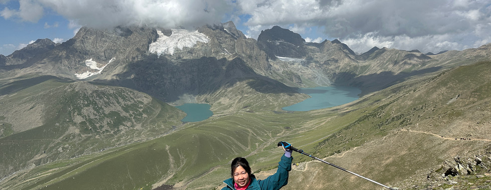
All the effort paid off, and we finally reached the Zaj Pass. Looking over the other side of the pass, we could see two big lakes; the view was indescribable. To take a commemorative photo I had to carefully walk to the edge while trying not to tumble down the mountain.
1020 | Heading down from the pass
After a short break, we began heading down the mountain towards the two big lakes. I could see the trail etched along the side of the mountain, extending towards the lake, and I felt we were like tiny ants walking on it. The downhill was definitely much more forgiving, and my lungs could finally take a break. The view accompanying our trek down overlooking the two big lakes—Gangabal and Nung Kul Lake—was one of the most beautiful sights of the entire trek. We couldn't help stopping at every opportunity for more photos.


1230 | Lunch on a field
The lakes looked impossibly far, but after a long downhill hike, we finally reached a flat clearing. We sat and had our lunch which was packed biryani.
After lunch, we continued walking along the vast field. We weren't sure where we were heading at first, but after climbing up a small hill section, we caught sight of the first lake - Gangabal Lake. We rushed to the lake to find a good spot to chill. It was an experience to just sit and admire the lake, dipping our feet into the cold, clear waters. It was one of the few times we were not rushing to the checkpoint and could just sit and take in the stunning views. Although we had been trekking through the mountains for days, the sight in front of us still felt surreal.


1420 | Head to campsite
We were reluctant to leave the beautiful lake, but had to continue the trek to the second lake, Nund Kul Lake, where our campsite was. We crossed a vast green pasture where the cows were grazing. The scene looked like it was right out of a dairy commercial. After crossing the green pasture, we caught sight of a smaller lake in the distance. We were made to cross a shaky plank along a fast-flowing river. Luckily, none of us fell into the river.
The campsite was just a short distance after. After reaching the campsite, the guide led us through some stretches, and then we were free to relax for the rest of the day. We were served pani puri for tea break that day. It was a nice treat for our last tea break, and it was super fun stuffing the shell with potatoes and pouring the soup in. We then headed to the river to wash up. It would be our last night camping, and I am excited to finally sleep on a proper bed the day after.
Day 7 - Gangabal to Naranag
0630 | Breakfast and set off |
0700 | Heading up the ridge |
0730 | One last army checkpoint |
0800 | Walk along the treelined path |
1000 | Our last maggie break |
1100 | A steep downhill climb |
1300 | Back to civilisation |


0630 | Breakfast and set off
We have finally reached the very last day of the trek! I could feel the fatigue built up from the past week of trekking, but we were ready to give it one last push trekking back to civilisation. I could no longer stomach the food provided at this point, so I opted for some energy bars instead. Some from the group decided to stay for another night to enjoy the campsite, but we opted to head back out to civilisation. We bid a last farewell to the campsite and goodbye to the camping life!
0700 | Heading up the ridge
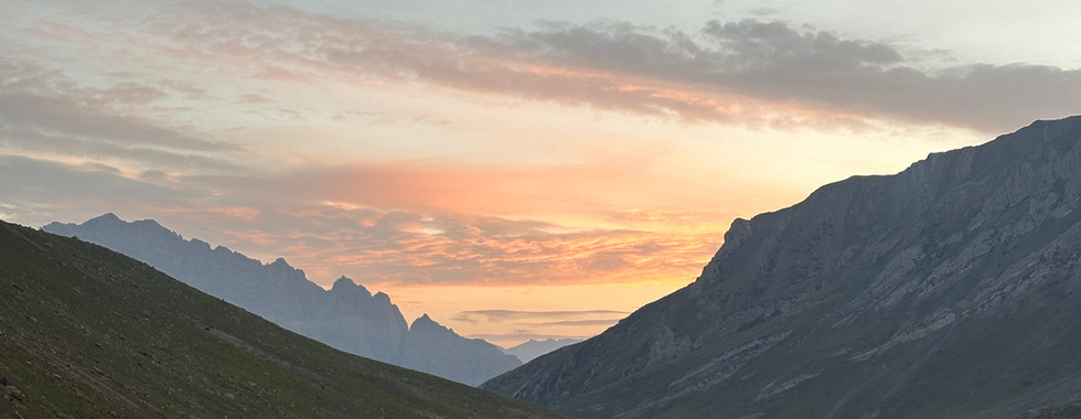
For the first section of the hike, we gradually headed up the side towards the ridge. The view was phenomenal as the morning light backlit the mountains, creating a layered landscape with rays of light filtering through. I took the time to take in the scenery, knowing that it would be the last day to immerse in this surreal beauty of a landscape.
We eventually reached the top and were greeted with beautiful views from both sides of the ridge. As we headed down the other side of the ridge, we were greeted by a couple of weekend hikers taking their dog for a leisurely hike. There were also soldiers carrying rifles, patrolling on this side of the ridge.


0730 | One last army checkpoint
We walked across a vast field with the familiar sight of herds of sheep grazing the grass, having their early morning breakfast. We then spotted the first sign of civilisation - a few small houses in the distance! The bare mountain landscape also started to change to a forest of tall coniferous trees. Since these trees can't grow at high altitudes, it was a sign that we had reached a much lower altitude. We walked towards the small cluster of houses. This was the last army checkpoint we had to pass before continuing descent. They did the routine document check and called out our names one by one, but this time around they did a more thorough inspection of our bags, likely to check for drones.
0800 | Walk along the treelined path
We continued along the tree line path. It was a very different scenery from the past week - seeing the mountain covered in tall coniferous trees. The trail was straightforward at this section, but the progress was slow due to the narrow path. If someone slowed down, there would be a jam. We also had to constantly keep our ears peeled for the sound of mules and quickly perch on the side of the mountain for them to pass.
1000 | Our last maggie break
This part of the trail felt long and monotonous. Hence, we were super excited when we finally spotted a wooden hut in the distance. This was the last (and also biggest) maggie point along the trail and everyone crowded in for a short break and some curry maggie to fuel up. The smoke and smell of burning wood were overwhelming. This was the first time we had to order food for ourselves (usually the guides would order for us), and we were not prepared for the chaos that ensued... We gave the counter staff our orders and waited patiently at first. Every time a plate of maggie came out, it was snatched up quickly. It was hard to tell whose order it was since it was either curry maggie or omelette, and the language barrier did not help. After a painfully long wait, we realised the only way to get any food was to be as aggressive as the locals. Although this was one of the rarer bad experiences we had, we were super grateful to our fellow local hikers who negotiated with the owners to secure food for us! We practically inhaled the food once it was in our hands, starving at this point!


1100 | A steep downhill climb
After surviving the chaos in the maggie hut, we were fuelled and ready to go. We turned a corner and saw the steep downhill section we had been dreading. The steep downhill section descends about 1000m within a short distance, and the trail was covered in loose and uneven rocks, making it extra slippery. My friend fell at least four times in this section, and I probably fell twice, lol. It was amazing to see the mules walking down this steep trail with the load they were carrying, albeit precariously. Our guide carefully guided us along this trail while avoiding the mules.
Midway down was a shelter where we took a short break. I was pretty low on energy at this point, but I knew the end was close, and we had to power through. I saw a mule carrying a very different load from the rest: it had a sheep strapped to its back. It might have been sick or injured. After another distance of steep descent, and it was heartening to catch sight of a small village at the foot of the mountain. It was the town we were headed towards - Naranag. Our spirits were high as we could now see our end goal. With every hairpin turn, we could see the town getting bigger and bigger. Before long, we passed the milestone gate into the town, marking the end of the Kashmir Great Lakes trail! The sun was scorching hot, so we quickly took our commemorative photo before rushing into a food stall.
1300 | Back to civilisation
The first thing I did was to buy an ice-cold Pepsi and connect to the stall Wi-Fi. It felt odd to be back after being off the grid for a whole week. After sending out some texts to assure our friends and family that we were alive, we quickly informed our accommodation in Srinagar that we were arriving a day earlier. Luckily for us, they responded that they could accommodate our early arrival. Since our transport was scheduled for the next day, the guides helped us arrange for a last minute transportation back to Srinagar. For the first time, I welcomed the sound of aggressive honking as we head back to Srinagar haha.
Exploring Srinagar


Staying on a boathouse
One of the best decisions we made was to stay on a boathouse in Srinagar (my friends were skeptical of this at first but I insisted). It was a super unique experience where a boatman would pick you up from a designated pier on a shikara (water taxi) and paddle you out to the middle of the river where there is a whole cluster of boathouses. The calmness and serenity of the Dal river was a stark contrast to the otherwise chaotic India traffic. The boathouse itself was surprisingly big and extravagantly decorated with about 3-4 rooms per boat. You could also request them to cook up any menu items. One thing that impressed me was how opportunistic the locals were; they would literally paddle their boat out to the middle of the river to sell us their wares, from small knick-knack souvenirs to satay and even saffron.
We were dead tired the day we arrived back in Srinagar, so we practically lounged around the boathouse the whole afternoon and got them to cook an 'Asian' meal for dinner (sorry, but no more chapati and dal for me). Once night fell, we sat on the front porch with a hot cup of kehwa tea while enjoying the night view on the river, the best way to unwind after a full week of trekking.


Day tours in Srinagar
I actually fell quite sick the next couple of days and had zero energy to do anything. But it's such a rare opportunity to be in this beautiful town in the Indian Himalayas that I had to lug my sick ass around haha.
These are some places we visited during the few days in Srinagar town:
Dal Lake morning market tour - it was 'compulsory' for us to do at least one shikara tour since we booked a houseboat, or so the owner says. But honeslty, it was so calming to paddle around the lake in the early morning exploring a whole floating town (shops, restaurants, markets, and even a mosque). Although the morning market itself was somewhat annoying since we were like sitting ducks and the vendor boats would keep coming over to tout their goods.
Lal Chowk - a bustling local market street where vendors would display their goods on a metal bed frame.
Pari Mahal - an old castle
Cheshmashahi - small manicured flower garden
Shalimar Bagh - very big and beautiful flower garden
Hazratbal - beautiful white mosque
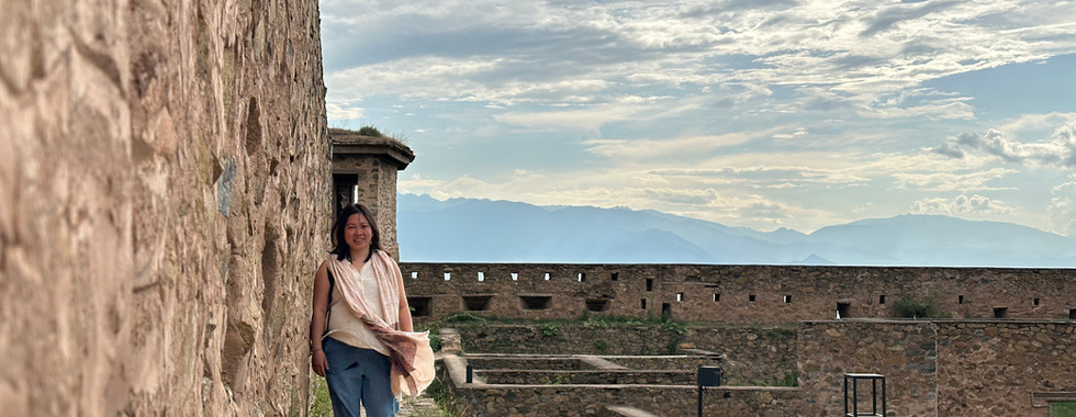
Hari Parbat - an old fortress perched on a hill
My Thoughts
Although this was a trip I booked on impulse (and kind of forced my friends to join), I was glad I took the leap of faith! The full week of trekking and camping in the Himalayas definitely put my grit to the test and pushed me out of my comfort zone, but the awe-inspiring views were more than worth it. They were not lying when they say this is the most scenic trek in India!
Also, do watch our trip video below (I took a lot of time to make it)!
Reference Map
Day 1:
Day 2:

Day 3:

Day 4:

Day 5:

Day 6:

Comments